| Goa गोंय | |||
|---|---|---|---|
| — State — | |||
| |||
 | |||
 | |||
| Coordinates (Panaji): 15.563°N 73.818°E | |||
| Country | |||
| Established | 30 May 1987 | ||
| Capital | Panaji | ||
| Largest city | Vasco da Gama | ||
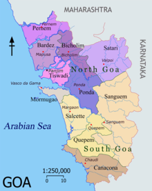
| Districts | 2 | ||
| Government | |||
| - Governor | Shivinder Singh Sidhu | ||
| - Chief Minister | Digambar Kamat | ||
| - Legislature | Unicameral (40 seats) | ||
| Area | |||
| - Total | 3,702 km2 (1,429.4 sq mi) | ||
| Area rank | 28th | ||
| Population (2011) | |||
| - Total | 1,457,723 | ||
| - Rank | 25th | ||
| - Density | 393.8/km2 (1,019.9/sq mi) | ||
| Time zone | IST (UTC+05:30) | ||
| ISO 3166 code | IN-GA | ||
| HDI | |||
| HDI rank | 3rd (2005) | ||
| Literacy | 87% (3rd) | ||
| Official languages | Konkani* | ||
| Website | goagovt.nic.in | ||
| ^* Konkani is the sole official language but Marathi is also allowed to be used for any or all official purposes. | |||

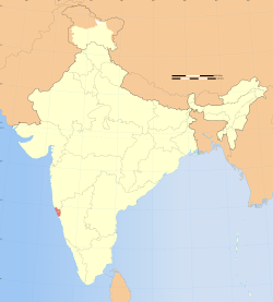
Goa ( /ɡoʊ.ə/; Konkani: गोंय) is India's smallest state by area and the fourth smallest by population. Located in South West India in the region known as theKonkan, it is bounded by the state of Maharashtra to the north, and by Karnataka to the east and south, while the Arabian Sea forms its western coast. Goa is India's richest state with a GDP per capita two and a half times that of the country as a whole. It was ranked the best placed state by the Eleventh Finance Commission for its infrastructure and ranked on top for the best quality of life in India by the National Commission on Population based on the 12 Indicators.
Panaji is the state's capital, while Vasco da Gama is the largest city. The historic city of Margao still exhibits the cultural influence of the Portuguese, who first landed in the early 16th century as merchants and conquered it soon thereafter. The Portuguese overseas territory of Portuguese India existed for about 450 years until it was annexed by India in 1961.
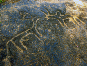
Renowned for its beaches, places of worship and world heritage architecture, Goa is visited by large numbers of international and domestic tourists each year. It also has rich flora and fauna, owing to its location on the Western Ghats range, which is classified as a biodiversity hotspot.